The 10 Most Important Ports in Mexico
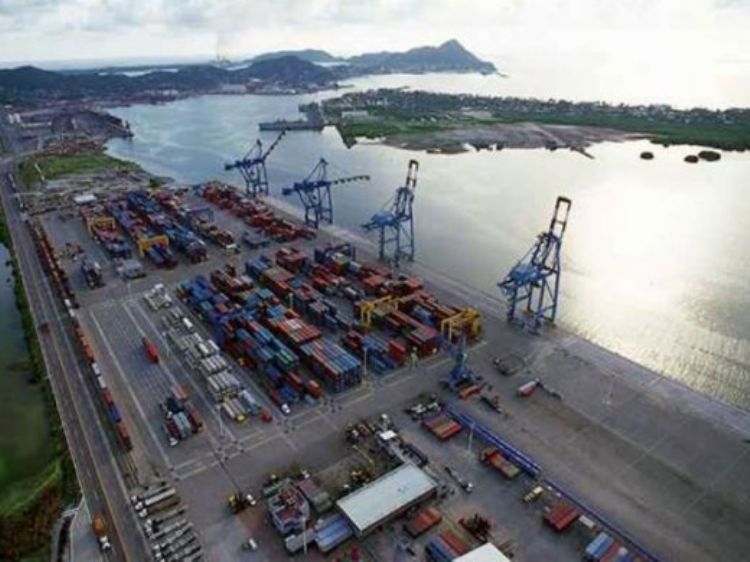
Port of Ensenada; This port is located on Mexicoâs northeast corner, in the estate of Baja California, 110 kilometers from the border between Mexico and the United States. It borders with the states of California, Arizona, Sonora and the Pacific Ocean. It is located in the Pacific Rim, the region with the worldâs greatest dynamics in commercial exchange, with the opportunity to access the main purchase and production ports and centers, registering a connection with 64 ports in 28 countries. Outgoing exports from this port are mainly directed to China, Hong Kong, Korea, Japan, Malaysia, Taiwan and Indonesia in Asia; Costa Rica, Honduras and Chile in Central America; France, Italy and Spain in Europe; besides morocco and Algeria in Africa. Imports received at this port come from the same countries in addition to Nicaragua in Central America and New Zealand in Oceania. Asia is the continent it holds greatest dynamism with due to the commercial exchange of the manufacturing industry.
With a radius of action of more than 1500 Km., the main highways connect the port to the cities of Tijuana, Tecate, Mexicali, Hermosillo, San Diego, Los Angeles, Tucson and Phoenix. This port has access to border crossings at Tijuana, Tecate, Mexicali, Nogales, Agua Prieta and Ciudad Juarez. This gives it access to the main highways and railroads of Mexico and the United States. Port of Ensenadaâs zone of influence hosts more than 1,400 manufacturing plants and 1,114 producers established on national territory.
Outstanding among the multiple activities of the Port of Ensenada is the industrial activity of containers and general freight, commercial fishing, cruise ships, sports fishing, shipyards and mineral handling.
In 1602 Spanish conquerors named it âEnsenada de Todos los Santosâ because they arrived at the port on the first of November. In 1877 it started to function as a port for commercial exchange. In 1919 it was granted a concession for the construction of a dock; during the 1920âs and 30âs, north American ships used the port of Ensenada to dodge the Prohibition Law. In 1976 it was ratified as a seaport. In 1991 container ships stopped arriving at Ensenada due to their new dimensions, so it began to develop as a tourism destination. In 1994 it began its modernization in order to adapt to the demands of international sea commerce.
Port of Veracruz
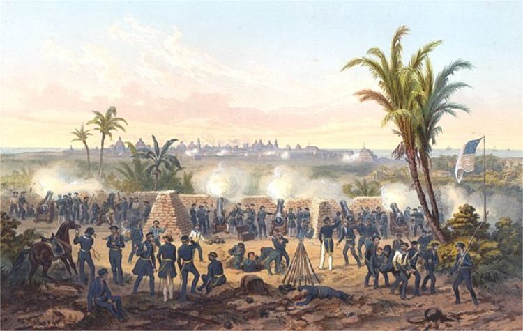
The port of Veracruz has been the scenario of some of the most important moments in Mexicoâs history. During the Spanish conquest, it became the port of entry to the new world with the arrival of Hernán Cortés in the XVI century. During the Colonial era, Veracruz was a crucial point for the exchange of communication and commerce, besides its strategic location, it was also outstanding for its agriculture, livestock and textile industry wealth. In 1864, Veracruz was where the Archduke Maximilian of Hapsburg and the Empress Carlota arrived to establish the Second Empire, In 1900, there was a strike by textile workers, the movement that lead the way to the Mexican Revolution. In 1911, General Porfirio Diaz abandoned the country through the port of Veracruz after being overthrown by the revolutionary movement. The port of Veracruz is known as Three Times Heroic for the valor and patriotism with which it faced the occupation of military forces from United States in 1847 and 1914, plus the French invasion of 1862.
The port has an extension of more than 600 hectares, on land and water, with 19 docking stations on nine docks with container, multiple uses, automobile, fluids, minerals and agricultural terminals. There is also a dock receiving cruise ships and another of PEMEX. The merchandise transferred at the port of Veracruz is for domestic use and exports to and from Florida, Europe and the north of Africa.
Currently, this port is applying an expansion project with the investment of 2,311 million dollars in order to increase its capacity, which will pass from 19.5 million tons to 118 million. The expansion will add 34 docking stations in an area of 300 hectares. This will enable it to receive ships with a capacity of up to eight thousand 500 containers.
Port of Tampico
Tampico is considered the second seaport of importance in the Gulf of Mexico and nationally. Located on the banks of River Panuco, it developed to service the companies established in the area, besides servicing great companies from around the world on its public terminals with 2,147 meters of docks, 6 private terminals and 10 patios fro the construction of marine platforms.
Its most important connections internationally are with Japan, Russia, Canada, United States, Belgium, Australia, Germany, Brazil, England, Cuba, Bahamas, Panama, Chile and Colombia. Nationally, it occupies third place in handling loads of general and mineral bulk, fifth place in agricultural bulk and fourth in contained loads. It is an important port of entry for international commerce in industrial, agricultural and mineral exchange thanks to its excellent railways and highways with the countryâs main industrial corridors and marine links with the world.
The port of Tampico is outstanding for being the national leader in handling iron in diverse presentations; in four months of the year 2008 it moved 335,000 tons of imported iron.
Port of Progreso
It is the first seaport and the most important on Yucatanâs coast. It is located in the Gulf of Mexico, to the north of Merida, capital of the state of Yucatan. It is a dynamic center for the fishing industry and the containers industry. It was founded in 1811 in what once was El Progreso Ranch. It served as one of the main communication routes of the peninsula with the rest of the country and the United States, playing a key role during the henequen boom for its export.
It is vastly connected thanks to the great amount of railways and highways that converge and the city of Merida. The main markets of the Port of Progreso are at the Gulf of Mexico and Mexicoâs center region; internationally, it is an important site for tourism and the establishment of manufacturing plants. It is also one of the newest ports for cruise ships; where tourists disembark to visit Progreso, Merida and the archeological Maya sites of Uxmal and Dzibilchaltun.
Port of Coatzacoalcos
This port has a privileged geographic location on the furthest end of the inter-oceanic corridor of Tehuantepec Isthmus, the shortest land route between the Pacific Ocean and the Gulf of Mexico, only 305 kilometers long. This port is on the southern area of the state of Veracruz, bordering with the Golf of Mexico and the state of Tabasco. It also borders with shipyards from the Ministry of Marine and the oil complex of Pajaritos. It spans 352 hectares, with 122.3 on land and 229.7 on water.
Its area of influence includes important center of production and consumer centers of the oil and agricultural industry. Load traffic is mainly constituted by sulfur, sugar, chemicals, fertilizers and mineral bulk. Specially oil and petrochemical derivates that are handled at the Marine Terminal of Pajaritos, which despite being outside the portâs premises, contributed significant income to the port for the ships that dock at this terminal.
Port of Topolobampo
This commercial and industry port is located in th estate of Sinaloa, on the countryâs northeast, on the coast of the Pacific Ocean, 200 miles from the entry to Gulf of California. For being located in one of the regions of greatest agricultural production in Mexico, 49% of this portâs exchange is bulk corn. Topolobampo is linked to important border cities, such as Culiacan and Mazatlan. Its privileged location allows it to handle products from and to Asia, southern United States and all of Mexico. The port has a terminal of Ferrocarriles Mexicanos and the Pacific route. It also has access to a vast highway network that links it to the rest of the country. This is crucial for exports and production of the fishing, agriculture and mining industries, besides the supply of products to the states of Sinaloa, Sonora, Baja California Sur and Chihuahua.
This modern seaport was inaugurated in 1991 in order to consolidate the commercial expectations of Mexicoâs northeast region. It has an ideal infrastructure for handling containers and receiving great ships, allowing it product exchange with Japan, Korea, Taiwan, Singapore, Hong Kong, Australia, Canada, New Zealand, and Central and South America. Its privileged position in the Pacific Rim makes it and ideal port for commercial exchange with Asian markets.
Puerto Vallarta
Puerto Vallarta is located in Banderas Bay, in the state of Jalisco, on the coast of the Pacific Ocean; it is mainly dedicated to tourism. The port terminal of Puerto Vallarta began its construction in 1968 with resources from the federal government. Currently, it can receive ships of more than 70 thousand tons of net register and approximately 2,500 passengers. Its infrastructure is completely dedicated to tourism, for which it offers docks, patios, gardens and boardwalks. The port has the capacity to service three cruise ships simultaneously.
The cruise ship industry has become the one with greatest development in Mexico, for which docks, terminals and service providers have developed for the passenger ships. In 2006, the ports of Mexico received more than 6 million tourists in 2,901 cruise ships, making it one of the worldâs most visited destinations. During that same year, Puerto Vallarta received 235 cruise ships and 503.4 thousand passengers, participating in 8.2% of the national total.
Port of Salina Cruz
The port of Salina Cruz is located in the state of Oaxaca, on the north of the Gulf of Tehuantepec, in the Pacific Ocean. It is catalogued as seaport and coastal shipping port. It holds its greatest load Exchange with Veracruz, Chiapas, Oaxaca, Tabasco, Campeche, Quintana Roo, Yucatan and Puebla.
Despite its closeness to Port of Madero in Mexico and Port of Quetzal in Guatemala, these present no competition due to the low development of the first and the foreign location of the latter.
Salina Cruz has one of the most important oil refineries on the Mexican Pacific, called âIng. Antonio Dovali Jaimeâ, managed by PEMEX. It also has the presence of Mexicoâs Military Ministry with a shipyard, besides qualified equipment and personnel to safeguard the port of Salina Cruz.
Port of Mazatlan
The port of Mazatlan is located in the state of Sinaloa, in front of the southern side of Baja California Peninsula. This port, besides being an important fishing and tourism center, is also the most important link between Mexicoâs western coast and the cities of Los Angeles and Panama. It is at the point where the Pacific Ocean converges with the Sea of Cortes, also known as the Gulf of California. The state of Sinaloa borders with the states of Chihuahua, Durango and Nayarit, its capital is Culiacan. The landscape of Mazatlan port is beautifully formed by the Sierra Madre Occidental and 16 miles of white sand beaches. Ships and the shrimp fishing fleet are separated from the beaches thanks to the port being located on a small peninsula that projects towards a natural bay.
Mazatlan started functioning as a formal port 170 years ago, established by Marine Customs to service ship traffic in 1828.
Commercially, Mazatlan serves the states of Nayarit, Durango and Jalisco; it also supplies the peninsula of Baja California. 85% of the loads managed at the port of Mazatlan are chickpeas, tuna, tomato and bean. Lately, it has added vehicle exports, representing 15% of its income.
Mazatlan is a commercial, tourism and fishing port; being the port for container, general loads, vehicles, cruise ships, ferries, oil and tuna ships. In the secondary sector, the most important activity is the one related to processing and packaging of sea products. In the tertiary sectors, thanks to the great natural attractions and infrastructure of Mazatlan, its most important income comes from services related to tourism.
Port of Manzanillo
The port of Manzanillo is located in the state of Colima. Its strategic location makes it the main link between the Pacific Ocean and the countryâs most important commercial and industrial corridor, constituted by the states of Aguascalientes, Jalisco, Guanajuato, Nuevo Leon, Coahuila and Mexico City; besides being an ideal position for commerce with the United States, Canada, South America and the countries of the Pacific Rim.
Operating at this port are some of the most important companies, such as Peña Colorada with the countryâs most important iron bed, the worldâs leader of pectin production; the Tecoman plant producing 2â500,000 tons per year of cement; and the ships that capture, process and distribute more tuna products in Mexico.
The port of Manzanillo extends over 437 hectares, including water areas, docks and storage facilities. Currently, it has 17 docking positions and 14 hectares of storage facilities equipped with 13.5 kilometers of railways and 5.4 kilometers of highways. The 26 sea lines that regularly dock at Manzanillo connect it with 74 destinations worldwide.
Artículo Producido por el Equipo Editorial Explorando México.
Copyright Explorando Méxicos, Todos los Derechos Reservados.
Foto: Infotransportes.com

